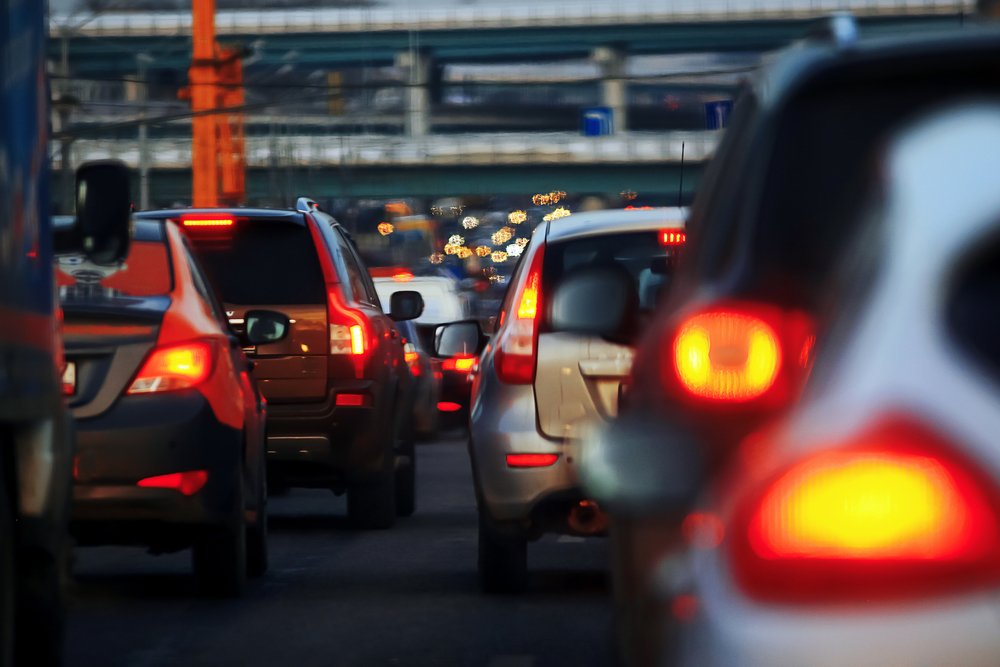
Esher Green – Accident Hotspot?
Recently there has been another accident at the junction of Esher Green and Church Street in front of the War Memorial.
As you all probably know there are plans to relocate the memorial later this year with long standing campaigner Cllr David Archer confirming that the move expected to start as early as April or May.
What you may not know is the extent of a 2017 feasibility study into a collision reduction scheme conducted by Surrey County Council which proposed 9 improvements for consideration – you can see all 9 proposals and the final 4 phased recommendation at the end of this article.
Following a local residents post regarding last weeks crash in our Esher Community Facebook group (Original post can be found here) we are grateful to Surrey County Councillor for Esher, Cllr Peter Szanto, for sharing the following information regarding a recent study by Surrey County Council on additional collision reduction options.
“I fully agree with comments about the dangers of this junction and the need to seek improvements.
It may interest readers to know that Surrey County Council carried out a study of collision reduction options at this junction which was reviewed by the Elmbridge Local Committee on 14th September last year, the agenda and minutes of which can be found here:
https://mycouncil.surreycc.gov.uk/ieListDocuments.aspx?CId=156&MId=5554&Ver=4
Measures that could be delivered quickly to mitigate the high frequency of casualties at the junction of Lammas Lane, Church Street, and Esher Green.
A number of options have been developed and presented to the Task Group for discussion.
The feasibility report recommends a progressive phased approach to the implementation of some of the options.
The recommended phased delivery includes monitoring and review following completion of the different stages.
This is intended to enable an evidence based decision to be made before the implementation of successive phases. If the casualty frequency reduces following implementation of the early phases, it may not be necessary to deliver all the suggested phases.
It is recommended to implement Phase One and Two of the suggested options in Annex F with the objective of reducing the frequency of casualties at the subject junction.
These phases include:
- A review existing signage to ensure that clear and concise information is provided.
- Placing the existing controlled pedestrian crossings in both Lammas Lane and Church Street on raised road tables.
The Elmbridge Local Committee (comprised of County & Borough Councillors) approved the review of the existing road signs at Esher Green and the implementation of one new road table at each of the existing pedestrian crossings in both Lammas Lane and Church Street.
In view of other potential changes in the area (the imminent relocation of the war memorial), it was felt that an incremental response is the most appropriate at this time.
Councillors were in agreement with this approach, but wanted to ensure that the momentum continues and that further measures are put in place if the early changes are not successful.
The meeting also reviewed an Esher Traffic Survey One of the major findings of the report is that on any given term time weekday approximately 84% of vehicles in Esher Town Centre are “through” traffic, with neither origin nor destination within Esher.
The Task Group agreed that the remaining budget should be used to develop a scheme, which would include:
- Optimisation of the traffic signal operation; using modern synchronised traffic signals could improve the ability of cars to get through Esher and reduce congestion.
- An investigation of options to provide new pedestrian crossing facilities where gaps currently exist (for example there is currently no controlled crossing over the exit road from the Civic Centre, at its junction with Portsmouth Road).”
We took a look at the agenda report pack and it makes very interesting reading and shows that Surrey County Council are taking this issue seriously.”
The original document can be found here:
Agenda, Decision and Minutes – Elmbridge Local Plan September 17th 2017
Esher Green, Esher – Collision reduction scheme
Surrey County Council Feasibility Report
May 2017
This report is to investigate the feasibility of the range of measures that could help reduce the number of collisions that have been taking place at the junction between A244 Lammas Lane, A244 Church Street, A244 Esher Green, D6897 Esher Green (More Lane), D6897 Esher Green (one-way section) and D6897 Esher Place Avenue.
Several reports have been presented to the Local Committee in the past highlighting the collision issues with this site as well as making
recommendations.
A brief overview of the site’s history:
The existing junction layout was created in 1989 to address a significant accident and congestion problem. Key issues addressed at the time included:
- An ongoing accident problem of traffic turning right from More Lane into Lammas Lane and having priority over traffic exiting from Church Street.
- Traffic in Church Street waiting to turn left onto Lammas Lane frequently backed up Church Street and affected the operation of the
traffic signals in the High Street. - The lack of a dedicated lay-by arrangement outside Christ Church in Church Street resulted in hearses and wedding cars effectively
blocking Church Street. - No dedicated facility for vehicles waiting to turn right into Esher Place Avenue.
- The slip road across Esher Green towards Tellisford allowed two way traffic flow.
- Significant levels of traffic were using the residential More Lane in the morning and evening to avoid using Esher town centre.
All of these issues were addressed by the scheme implemented in 1989.
Following the introduction of this scheme an after study was completed and a number of minor changes were made between 1993 and 1998.
This included:
- Alterations of the existing road signage and lining to better define the junction priorities.
- Realignment and resizing of a number of the islands to create additional deflection and to increase the width of the movement from Church Street into More Lane.
- The laying of high performance coloured anti skid asphalt surface on the Lammas Lane approach to the junction.
- Improving the advance direction signing to Sandown Park, with particular attention to the rear entrance in More Lane as a number of those vehicles involved in accidents had been travelling to this expanding centre.
- Alterations to the lane markings in Church Street to try to improve lane discipline on the approach to the junction.
- Improvements to pedestrian facilities.
Having completed these measures there was still an underlying collision problem associated with the cross movement from Church Street into More Lane.
In 1999 funding was given to a feasibility study to arrive at a long-term comprehensive solution for the junction.
Recommendations were made, and there was then development of the two preferred options (a conventional (kerbed central island) roundabout and a realignment of the A244 Lammas Lane approach). With the termination of the Highway Agency agreement in
April 2002, the scheme was reviewed and a number of options (including a realignment, together with two traffic signal options and an experimental Bus-Gate proposal) were prepared for public consultation.
Following this consultation, the preferred scheme of re-aligning the Lammas Lane approach was given the most support.
This option was then to be developed alongside seeking to move the War Memorial, realigning Esher Place Avenue into More Lane, and discussing the possible closure of the one-way road across Esher Green toward Tellisford.
This was agreed at the Local Committee in March 2004.
In September 2005 a report was taken to the Local Committee to approve a detailed design of a scheme and agree the Statutory Procedures necessary to progress it.
The scheme that was for approval has Esher Place Avenue exiting as it does currently into Lammas Lane. The reason for this change
was because there was insufficient land to ‘swap’ for the Common Land that would be required to implement the original scheme.
To help minimise the impact this would have on Lammas Lane, it was intended that an island should be extended to essentially prevent right turn movements either into or out of Esher Place Avenue.
The War Memorial was still required to be repositioned to allow the scheme to implemented. There would also be two new signal controlled pedestrian crossing facilities to be constructed on Lammas Lane and Church Street.
In March 2006 a report was taken to the Local Committee as a result of objections received to the proposed restrictions to movements into and out of Esher Place Avenue. Recommendations were made that the design was developed to remove the need for these restrictions (see Figure 1).
It also said that monitoring of the location would be necessary following the construction of the scheme to ensure that road safety had not been compromised by this decision, and if it had, then to re-consider the implementation of the movement bans.
Since these reports the junction has benefited from two new controlled pedestrian crossing points as well as a minor improvement to the central island at the time of the London 2012 Olympic Games Cycle race.
The scheme that was agreed in March 2006 has not progressed from the design stage due to the requirement to reposition the War Memorial, where discussions are on-going.
Collisions are still occurring, and this report is to evaluate options to help to reduce the number of collisions, whilst at the same time avoiding the need to use Common Land, and/or the requirement for the War Memorial to be repositioned.
Site Analysis
Lammas Lane is a busy ‘A’ road linking Hersham to Esher, with a speed limit of 30mph. Church Street and Esher Green are also ‘A’ roads and make up part of the Esher one-way system.
On site observations have shown that the majority of traffic flows east to west from Lammas Lane to Esher Green, and north to west from Church Street to Lammas Lane. Currently both these routes have priority and do not require motorists to give way.
There are six roads that make up this junction, with 16 movements possible. These movements are managed by give ways signs and road markings and priority routes, and thus rely on drivers to have good visibility and the ability to adequately judge other vehicle’s path and speed.
Data Collection
Personal Injury Collisions
An assessment has been made of the personal injury collisions that have been reported by the police between the period 1st January 2011 to 31st October 2016, around the junction.
During this period there are thirty six recorded personal injury collisions, thirty had a severity of ‘slight’ and six ‘serious’.

Twenty six collisions took place during daylight, whilst ten were during darkness, but with street lights. The vast majority, thirty four, of the collisions happened when the road surface was dry. When the police attend personal injury collisions they assess and log the contributory factors that lead to the collision.
The table below shows all the factors that led to a collision that have been recorded at this location during this assessment period.
Some collisions have a number of factors attributed to them.

Over three-quarters of the recorded collisions involve two vehicles, one of which was travelling from west to east (from Hersham to Esher) and the other vehicle crossing their path by travelling south to north (Esher to Lower Green).
On site observations have shown that vehicles waiting at the Church Street junction to head north into More Lane have restricted visibility to the west.
This restriction is further reduced when a vehicle from Church Street is waiting to turn right into Esher Place Avenue.
Anecdotal evidence from a resident seems to suggest that there is an issue with drivers travelling north along Church Street and wishing to enter the one-way section across Esher Green towards Tellisford to access the onstreet parking that allows for non-permit holders.
The existing road layout does not provide clear instructions for drivers to make this maneuver, and this results in unexpected hesitancy and/or an inability for other drivers to correctly judge the movement, which in turn could result in a collision. It should be noted that none the recorded collisions provide enough detail to indicate this as a cause.
Discussion and Options
It should be noted that the options provided below reflect those that have been investigated and may not necessarily be options that would be recommended for implementation.
Do Nothing
The location has an on-going high level of personal injury collisions; by taking no action it would not address this issue. It is therefore not
considered a satisfactory option.
Do Minimum
Signing improvements on approaches and at the junction
Option 1a – Circulatory Design

Pros:
- Maintains all existing movements
- All works within highway extent
- Keeps more vehicles away from war memorials
- Road priority understanding improved
- Less arms at junctions (south-east turn incorporated)
Cons:
- Main flow of traffic (west to east) now has to give way – possible increase in congestion
- Doesn’t provide much deflection for west to east or south to north traffic entering junction
- Low speed shunts might increase as vehicles proceed to new give way
Option 1b – Circulatory Design with greater deflection than 1a

Pros:
- Maintains all existing movements
- All works within highway extent
- Keeps more vehicles away from war memorials
- Improved visibility at junction
- Road priority understanding improved
- Less arms at junction (south to east turn incorporated)
- Increased deflection for west to east traffic over Option 1(a)
Cons:
- Main flow of traffic (west to east) now has to give way – possible increase in congestion
- Doesn’t provide much deflection for south to north traffic entering junction
- Low speed shunts might increase as vehicles proceed to new give way
Option 1c – Circulatory Design with greater deflection than 1b

Pros:
- Maintains all existing movements
- All works within highway extent
- Keeps more vehicles away from war memorials
- Improved visibility at junction
- Road priority understanding improved
- Less arms at junction (south to east turn incorporated)
- Increased deflection for west to east traffic over Option 1(a) and 1(b)
Cons:
- Main flow of traffic (west to east) now has to give way – possible increase in congestion
- Doesn’t provide much deflection for south to north traffic entering junction
- Low speed shunts might increase as vehicles proceed to new give way
- Reduction of filter lane for vehicles travelling North into Esher Place Avenue
Option 2 – Speed cushions

Pros:
- Maintains all existing movements
- All works within highway extent
- Relatively cheap
- Reduces speeds on the approach and through the junction
- Main traffic flow route retain priority
Cons:
- Doesn’t improve visibility, which is believed to be one of the main factors for the collisions
- Increased distraction with the cushions being the main focus
Option 3 – Speed tables

Pros:
- Maintains all existing movements
- All works within highway extent
- Reduces speeds on the approach to the junction
- Main traffic flow route retain priority
Cons:
- Doesn’t improve visibility, which is believed to be one of the factors for the collisions
- Increased distraction with the road tables being the focus
Option 4 – Junction table

Pros:
- Maintains all existing movements
- All works within highway extent
- Reduces speeds on the approach to the junction
- Main traffic flow route retain priority
Cons:
- Doesn’t improve visibility, which is believed to be one of the factors for the collisions
- Increased distraction with the road table being the focus
- Vertical alignment change close to conflict point
Option 5 – Traffic signals

Pros:
- Maintains all existing movements
- All works within highway extent
- Improved visibility at junction
- Road priority understanding improved
Cons:
- Only south to west traffic is free flowing
- Area has numerous traffic signals and would need to be linked to ensure hold ups are kept to a minimum
- Some traffic signal heads would need to be placed on Common Land
- Feel of urbanisation
Option 6 – Junction priority changes

Pros:
- Maintains all existing movements
- All works within highway extent
- Slight improved visibility at junction
- Road priority understanding improved (giving way to vehicles from the right), although may increase confusion in the short term
Cons:
- Main flow of traffic (west to east) now has to give way – possible increase in congestion
- Doesn’t provide much deflection for south to north traffic entering junction
- Low speed shunts might increase as vehicles proceed to new give way
- Limited improvement of visibility
- Short term confusion to the changes may result in increased number of collisions
- No physical influence to speed
Option 7 – Removal of south to north movement

Pros:
- All works within highway extent
- Removes visibility issues at junction
- Removes all south to north with east to west collisions
- Main traffic flow route retain priority
Option 8 – Increased deflection along west to east movement

Pros:
- All works within highway extent
- Keeps more vehicles away from war memorial
- Road priority understanding improved
- Less arms at junction (One-way section of Esher Green closed)
- Increased deflection for west to east traffic
- Reduction of west to east vehicle speeds
Cons:
- Doesn’t provide much deflection for south to north traffic traffic entering junction
- Visibility for south to north traffic is less than existing
- Entry into One-way section of Esher Green removed, loss of parking
- Drop off area in front of Church is removed
Option 9 – Closure of one-way access road across Esher Green

Pros:
- All works within highway extent
- Main traffic flow route retain priority
- Reduces the number of possible movements and simplifies the junction
Cons:
- Doesn’t improve visibility, which is believed to be one of the main factors the collisions
- Removes parking for up to 5 cars
- Would make access to Tellisford in large vehicles more difficult unless accommodation works take place.
Recommendation
This junction, despite its numerous changes, still has a high number of personal injury collisions taking place. Whilst the scheme agreed in March 2006 should help to address this, because of the continuing delays in seeking permission to move the War Memorial and issues relating to Common Land, people are continuing to be hurt at this junction.
Whilst some of the options in this report are likely to have a greater effect on casualties, these would be very expensive and unlikely to be affordable in the near future. In addition, a large scheme at this stage could prove abortive if the Esher Transport Study concludes that a different arrangement would be beneficial when looking at transport / traffic patterns through Esher holistically.
It is therefore recommended that a phased approach be agreed, that will install measures that should reduce the number/severity of the
collisions whilst at the same time be conducive to whatever final scheme is delivered.
Phase One: Review existing signage to ensure that clear and concise information is provided. Provide additional signage only where a clear benefit can be established.
Phase Two: Place the existing controlled pedestrian crossings in both Lammas Lane and Church Street on raised road tables. This will help to reduce speeds with the intention of increasing the length of time drivers have of seeing each other, therefore have more time to react to any situation.
It also has the added benefit of adding to the conspicuousness of the pedestrian crossings. It is envisioned that Phases One and Two could take place as one initial stage, subject to funding. Once installed, a review period of one year will be needed to confirm the extent of change to the levels of collisions at the junctions.
A report should then be brought back to this Local Committee highlighting the comparison between the collision rates pre and post Phase One and Two works.
The Local Committee should then agree to either continue to monitor the collisions for a longer period of time, agree that the levels of collisions have been reduced to a level similar to other junctions in the county and thus no further action is necessary at this time or to
implement Phase Three.
Phase Three: Install an experimental restriction to right turn movements into and out of Esher Place Avenue, and an experimental closure of the oneway road across Esher Green to Tellisford (Option 9). Although the restriction of movements into and out of Esher Place Avenue have previously been investigated, consulted upon and ultimately rejected, this was based upon a design where those travelling south to north (Church Street to More Lane) did not have to give way to traffic on Lammas Lane.
It is considered that with the existing junction priority, removing vehicles from being able to wait to turn right from Church Street into Esher Place Avenue would allow greater visibility of/for oncoming traffic. Simply banning the movements is unlikely to have complete compliance, and therefore a physical restriction would be necessary. This experimental closure would then be followed by a period of monitoring of one year to see if there is a reduction in collisions.
A report should then be brought back to this Local Committee highlighting the comparison between the collision rates pre and post Phase Three works.
The Local Committee should then agree one of the following:
- That the levels of collisions have been reduced to a level similar to other junctions in the county and thus look to permanently ban the
movements and that no other works are necessary at this time - That the levels of collisions have been reduced slightly and look to permanently ban the movements and move forward to Phase Four
- That the temporary changes make little difference or increase collisions, then the layout should be restored to its original provision,
and move forward to Phase Four.
Phase Four: This phase would include a review of the remaining untested options (appendix 1-9), together with any new suggestions that come to light, to see whether further changes would be beneficial in mitigating the pattern of casualties.
________________________________________
Back to the What’s In Esher Homepage
________________________________________
Have you joined our Esher Community Group on Facebook?
www.facebook.com/groups/OurEsherCommunity/
Recent Articles:
________________________________________
Higher Council Tax To Fund The Police?
________________________________________
Esher – Perfectly Placed For Parents!
________________________________________
________________________________________